
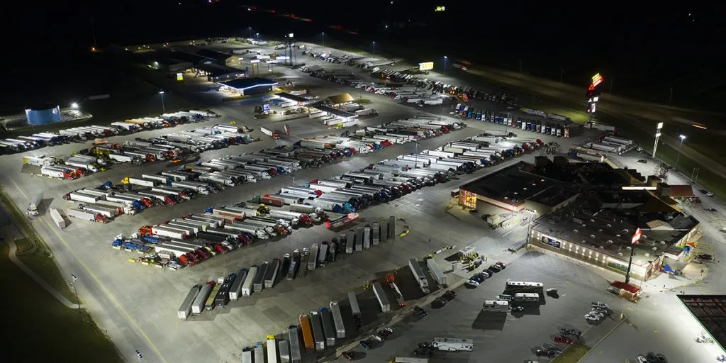
Most truck parking availability systems that disappoint were not undone by the signs or the software. They were undone by a detection decision made in the RFP, usually by picking a sensor before defining what "accurate" meant and who would keep it that way. This checklist covers the twelve decisions that determine whether the number on the sign holds up, in the order you will make them.
If you need the background first, start with how a TPIMS works and why counts drift.
Space-by-space occupancy is the most accurate and self-correcting, but hardware cost scales with the number of spaces. Entrance and exit counting is cheaper and scales to any lot, but errors accumulate until reset, and in a small lot a few misses are a large share of capacity. Do not pick one for the whole corridor. Specify per-space or a combined approach for small and medium lots, in/out counting with classification for large ones, and favor a device that can do both from a single mount.
Write the formula into the spec. The standard used in the MAASTO evaluations is one minus the absolute difference between reported and actual available spaces, divided by actual. Set the threshold (Iowa used 85 percent for small sites and 90 percent for large; Florida required 95 percent on occupancy and 90 percent on turnover), state how often it will be checked, and state what ground truth is. An accuracy number without a measurement method is a marketing claim.
A rest area driveway sees cars, pickups, RVs, and bobtails. A counter that cannot separate them is counting cars as trucks. Require truck-versus-car classification at minimum, and ask for FHWA 13-class output if you can get it, because the same sensor then produces the freight volume data your planning section has been asking for.
Most truck parking happens in the dark. Washington State's 2026 evaluation documented camera detection degrading in heavy rain, fog, snow, glare, and darkness, and the NCHRP guide notes freezing climates can affect in-ground sensors. Require the vendor to demonstrate accuracy at night and in precipitation, not just in the daytime acceptance test. See our sensor comparison for where each technology fails.
Iowa's pucks began failing after a year and a half and nobody knew for about a year. Require every device to report a heartbeat and status, require the central system to alert when a device goes quiet or a count exceeds capacity, and require a report you can review monthly.
The Iowa evaluators' top recommendation was "independent verification of parking data." That can be CCTV an operator checks from the TMC, or a detection device that keeps its own visual record. Specify that an operator can confirm the count remotely at any site without driving there.
The national guide expects "accuracy checks and count resets once or twice a day in most cases" for in/out systems. Write the operations plan now: who does it, from where, at what hour. Then require the detection layer to minimize it. Hard bounds (never below zero, never above capacity), a remote reset, and a cross-check against occupancy should be in the spec.
In-pavement pucks have to be replaced when the lot is resurfaced, and battery life is their documented weak point. Pole-mounted sensors avoid the pavement entirely. Ask for expected service life, battery or power requirements, and what happens to the count during a resurfacing project. Iowa's contract covered implementation, testing, and three years of maintenance together, which is the right way to see the real cost.
Parking counts in one platform, signs on another, and a TMC that sees neither is the failure mode the industry is trying to leave behind. Specify NTCIP to the dynamic message signs, a published JSON or XML feed for 511 and third-party apps (Iowa's feed had 35 registered consumers by 2023), and MS2 or an equivalent for the data warehouse. No proprietary middleware, no single-vendor lock on the data.
Drivers consistently rate roadside signs as their preferred source. The NCHRP guide recommends placing them three to five miles upstream of the facility and no more than 60 miles out. Iowa skipped signs, published to 511 and apps only, and instrumented more sites with the savings. Either is defensible. Decide deliberately, and set the message rules: when to show a number, when to show "FULL," and what buffer to hold back.
Rest areas vary. Some have power at the entrance, some do not. Specify acceptable power draw, mounting on existing poles or sign structures, cellular or wired backhaul, and a weather rating suited to the corridor (IP66 or NEMA 4 and an operating range that covers your winters).
Run the system for 30 to 60 days at two or three representative sites, compare it to ground truth daily, and apply the accuracy definition from item 2 at night and in weather. Accept only when it passes. Washington's finding that most technologies exceed 95 percent "when properly calibrated" is the reason: the pilot is where you learn how much calibration your corridor will need.
Every one of these is avoidable at the RFP stage. For agencies that want the detection layer to carry most of this list on its own, FusionSensor does the in/out count, 13-class classification, and spot-specific occupancy from one unit at the lot entrance, at 98.7 percent accuracy, in any weather, with on-device processing and a visual record for verification. It mounts on an existing pole in under an hour with no pavement cut, carries an IP66 rating from minus 30 to plus 75 Celsius, and publishes in NTCIP, SDLC, MS2, JSON, or XML. It is what runs New Mexico's I-10 corridor today. See the details on our truck parking management page, or request a demo and we will walk through your sites with you.
Subscribe to The Edge Brief for monthly field notes, deployment stories, and product updates.
Subscribe →